| Sabang | |||
|---|---|---|---|
| — City — | |||
| |||
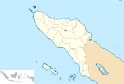
| Location of Sabang in Aceh | |||
| Coordinates: 5°53′39″N 95°19′9″ECoordinates: 5°53′39″N 95°19′9″E | |||
| Country | Indonesia | ||
| Province | Aceh | ||
| Government | |||
| • Mayor | |||
| Area[citation needed] | |||
| • Total | 118 km2 (46 sq mi) | ||
| Population (2000)[citation needed] | |||
| • Total | 23,654 | ||
| • Density | 200/km2 (520/sq mi) | ||
| Time zone | WIB (UTC+7) | ||
| Website | sabangkota.go.id | ||
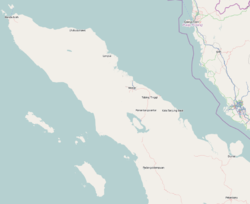
Sabang is a city consisting of several islands in Aceh, Indonesia. The metropolitan area is located on Weh Island, 17 km north of Banda Aceh. The city covers an area of 118 square kilometres and according to the 2000 census had a population of 23,654 people.Sabang is also known as the northernmost and westernmost city in Indonesia, located at 95.5 E, 6.0 N.
Islands
- Klah Island (0.186 km²)
- Rondo Island (0.650 km²)
- Rubiah Island (0.357 km²)
- Seulako Island (0.055 km²)
- Weh Island (121 km²)
Sabang is served by the Maimun Saleh Airport. The airport is located southeast of the city.
International sail tourism event
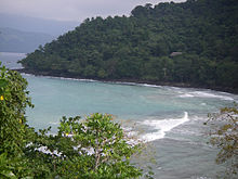
Sabang Municipality will host an international sail tourism event in September 2011. The sail race will be participated by around 50 ships with 15 crew members each. Besides sailing they will visit interesting places packed in a 'tsunami' tourism, visit Gapang and Iboih Beach with enchanting underwater scenery.


Tidak ada komentar:
Posting Komentar